
Casa Blanca Pacifica
Where San Pedro Creek meets the Pacific. A guide to exploring the coast, organized by distance from the front door.
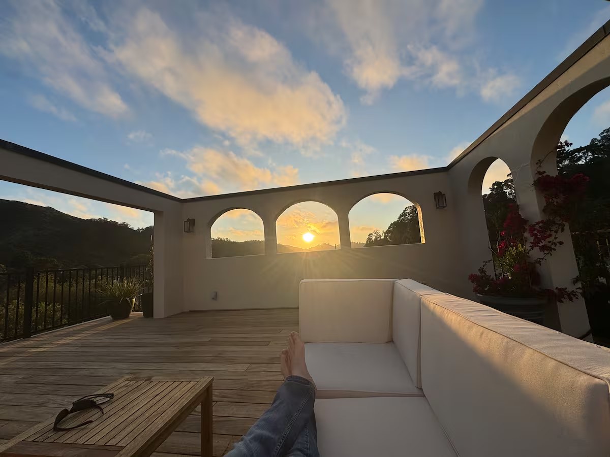
Welcome to Casa Blanca Pacifica
Nestled along the banks of San Pedro Creek and just minutes from the Pacific Ocean, Casa Blanca Pacifica was created to be more than a place to stay. It is a comfortable basecamp for exploring one of the most remarkable stretches of coastline in California.
From the rugged cliffs of Davenport and Santa Cruz to the fishing harbors of Half Moon Bay, the surf breaks of Pacifica, and the iconic landscapes of San Francisco and Marin, this region offers endless opportunities for adventure, relaxation, and discovery.
The recommendations here are not copied from travel websites. They come from decades of personal experience and countless days spent exploring this coast, surfing its waves, hiking its trails, riding its ridges, and learning from the people and wildlife that call it home.
"Everything in these pages is merely a suggestion, a starting point, not a checklist. If any of it is on your list, including mountain biking, hiking, swimming, surfing, paddling, wing foiling, or boating, please do not hesitate to ask. I will happily dump far more information on you than you could ever possibly want, because I love to share what this place has given me. There are more amazing nuggets within walking or riding distance of the house, or quite simply at the house, than I could ever fit into a book. Just ask, and we will find the ones that are right for you."
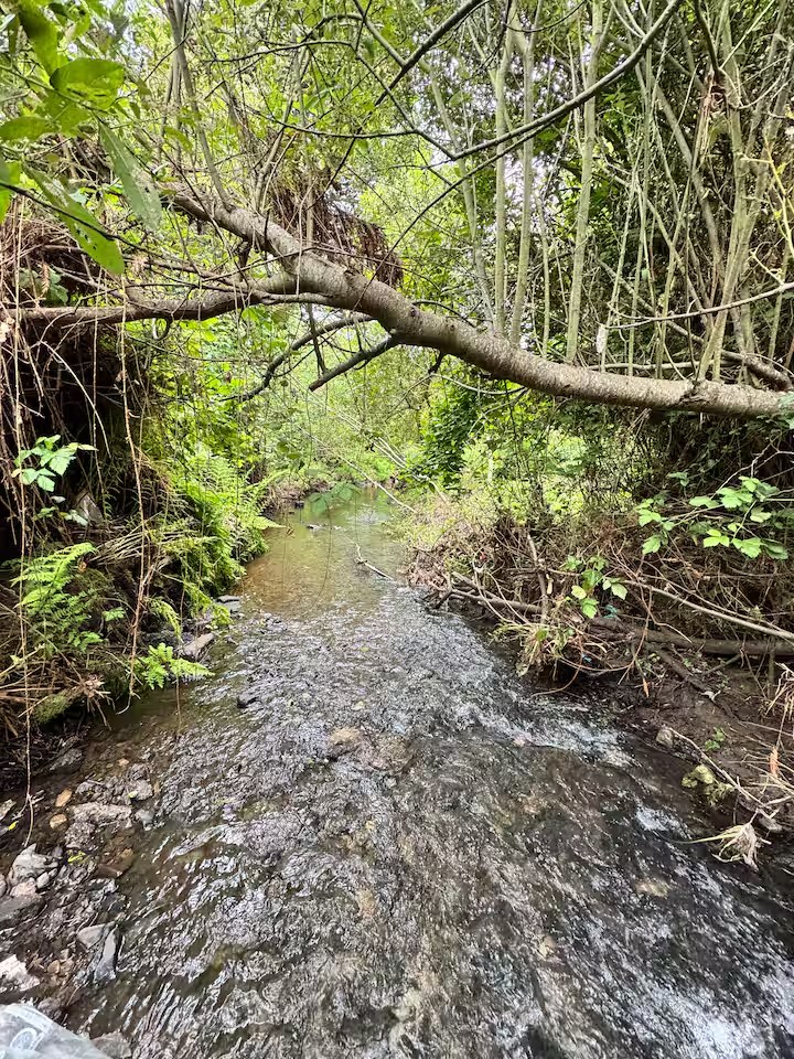
The best moments here are often the simplest: fog over the mountains, the creek after rain, the sun disappearing into the Pacific.
A few words from Greg
Thank you for choosing Casa Blanca Pacifica. When I point you toward a trailhead, a break, or a quiet bend in the creek, it is because I have been there many times and want you to feel the same thing I did.
Some of the best moments here are the simplest:
- Watching fog roll over the mountains
- Spotting a hawk soaring above the canyon
- Hearing the creek after a winter rain
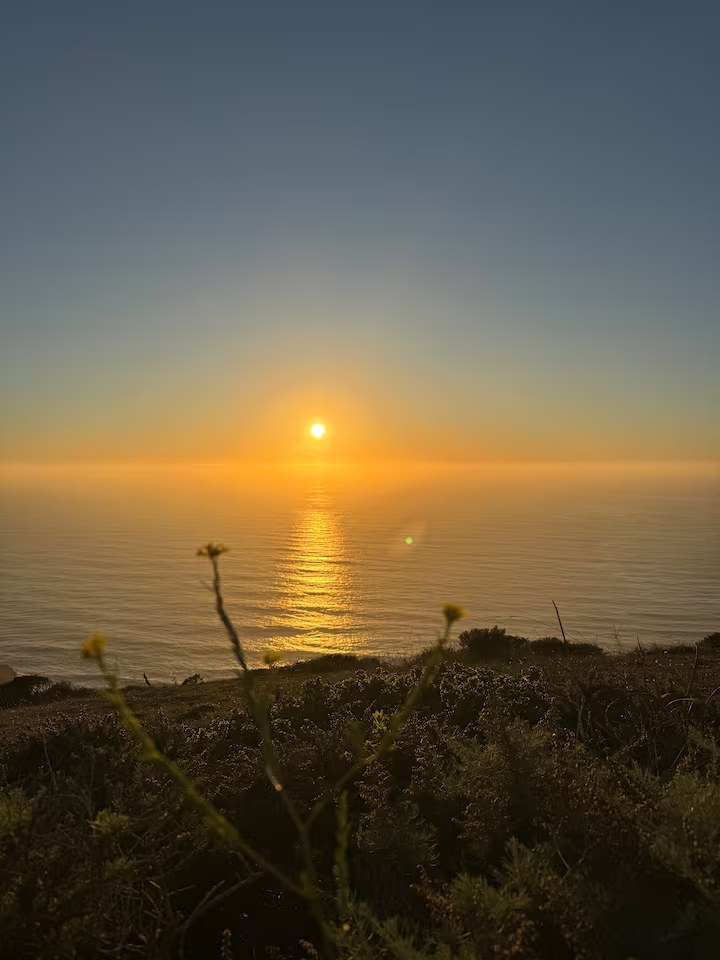
- Watching the sun disappear into the Pacific
- Sharing stories with new friends after a day outdoors
My hope is that your visit creates a few of those moments as well.
Welcome to Pacifica.
Greg, Steward & Host
Before the coast calls, the property itself is part of the stay.
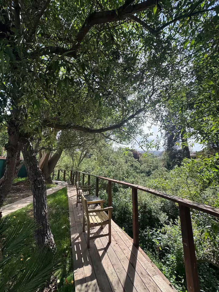
The heart of the property
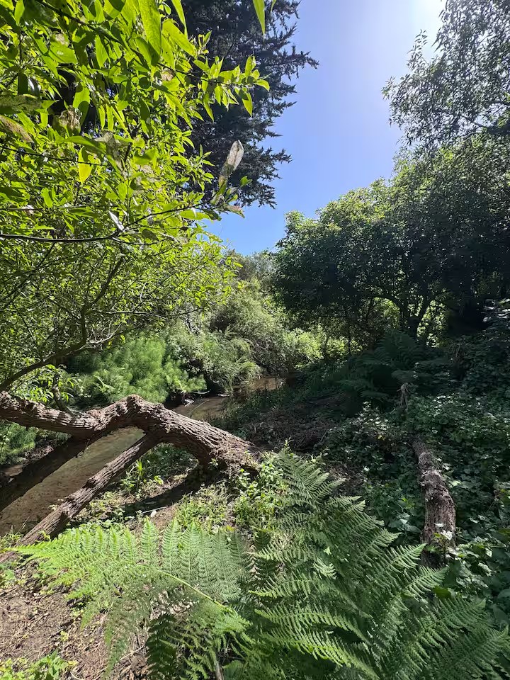
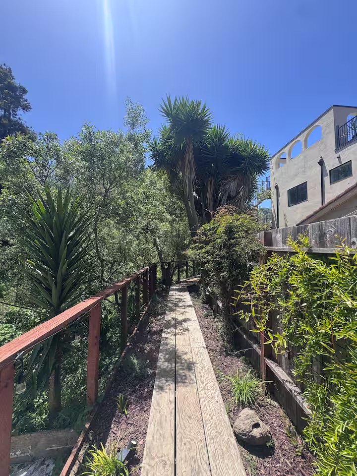
San Pedro Creek is one of the defining features of the property and one of the reasons Casa Blanca Pacifica exists. The creek corridor provides habitat for native wildlife and serves as seasonal steelhead spawning habitat. Many guests tell us the sound of the creek becomes one of their favorite memories, a soft current beneath everything, especially after a winter rain.
Please observe wildlife from a distance, keep to the paths, and let the creek stay wild. You are standing in active restoration habitat, and every quiet visit helps it recover.
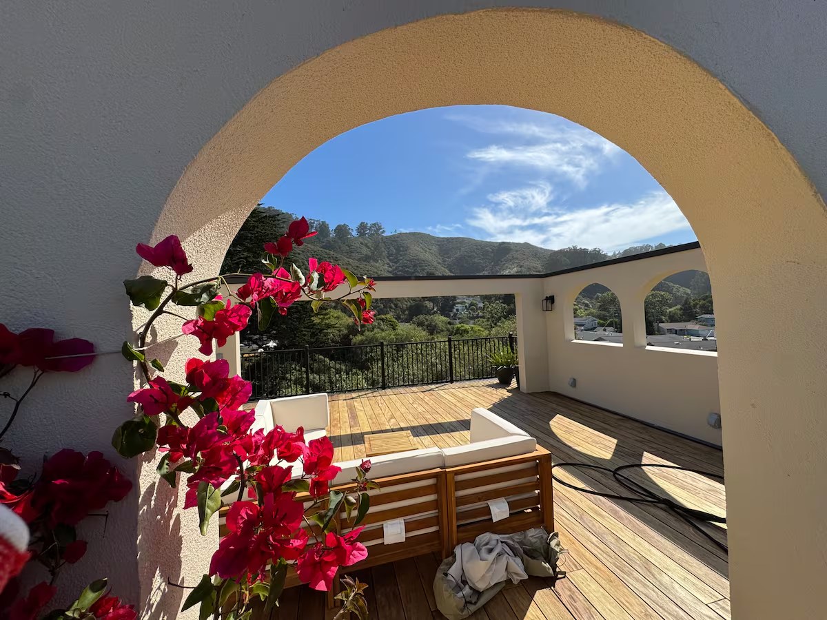
Slow down
The rooftop deck is one of the most popular spaces on the property, ideal for morning coffee, reading, sunset, and stargazing. On clear evenings, the combination of ocean air, mountain views, and coastal sunset can be spectacular. After a day spent hiking, surfing, or biking the coast, the infrared sauna and outdoor shower are waiting.
Slow down. Take a breath. Enjoy the moment.
Everything here is organized in rings, measured from the front door.
Rather than sort by activity alone, we have arranged by distance. Decide how far you feel like going, and the options for that distance are gathered in one place.
At the House
On foot: the creek and San Pedro Valley Park
Bike & Short Hop
Linda Mar, the beach, the Pacifica bluff trails
The Coastside
Pacifica south to the Ritz-Carlton, Half Moon Bay
Beyond
Pescadero, Santa Cruz, San Francisco, Marin
The guide is split into two parts that use these same rings. Part One, Things to Do, covers hiking, surfing, biking, and the rest. Part Two, Food & Drink, covers coffee, dining, and bars. You might pick a hike from Ring 2 in the first part, then turn to Ring 2 in the second part to find coffee and lunch nearby. Same distances, kept separate so neither gets crowded.
Drive times throughout are rough door-to-destination estimates on Highway 1 with normal traffic, so add a little on summer weekends. And whatever you are planning, just ask me. A quick read on the day's swell, wind, tide, and fog turns a good outing into a great one.
Things to Do
Activities by distance, from a walk out the back door to a day down the coast.
On foot · walking distance
Some of the best hours of your stay never require a car. Right out the door lie the creek and, just behind the neighborhood, the closest and most rewarding network of trails on this stretch of coast.
Hiking: San Pedro Valley Park
Tucked at the back of the Linda Mar neighborhood, this is the closest and most rewarding network of trails to the house, walkable from the door. There is a small day-use parking fee if you drive (bring a few dollars cash), a visitor center, and restrooms at the trailhead.
- Brooks Falls LoopEasy–moderate · ~2.8 mi
A lush loop to a seasonal three-tier waterfall that is most impressive after winter and spring rains. The classic short hike in the park, with Pacific views from the upper trail.
- Hazelnut Trail LoopModerate · ~4.25 mi
The longest loop inside the park, but gentle switchbacks keep it manageable. Climbs through ceanothus, manzanita, huckleberry, and eucalyptus, then descends to the flat Weiler Ranch Road. Great ocean and Montara Mountain views, something blooming nearly year-round.
- Valley View Trail LoopEasy · ~2.0 mi
A shorter loop through eucalyptus grove and grassland with surprisingly big views for the effort. A good first-morning leg-stretcher.
- Weiler Ranch RoadEasy / flat · ~1 mi each way
A level gravel road along the South Fork of San Pedro Creek, perfect for a relaxed walk.
You need not go anywhere at all. The creek corridor at the property is seasonal steelhead habitat and a quiet world of its own, with herons, songbirds, and the sound of moving water. Walk it slowly, keep to the paths, and see the Wildlife chapter near the back for what to look for.
A soft current beneath everything, especially after a winter rain.
San Pedro Valley Park is my go-to when I have an hour and want green canyon and birdsong without a long drive. After winter rains, Brooks Falls is worth the detour. Keep an eye out for poison oak on the narrower trails, it grows well here.
A few minutes · by cruiser or short drive
This is the heart of Pacifica: the home beach, the dramatic coastal bluffs, and the local rides, all reachable on a cruiser or with a five-minute drive. If you do nothing but work this ring all week, you will not run out of coast.
Surfing: Linda Mar, the Home Beach
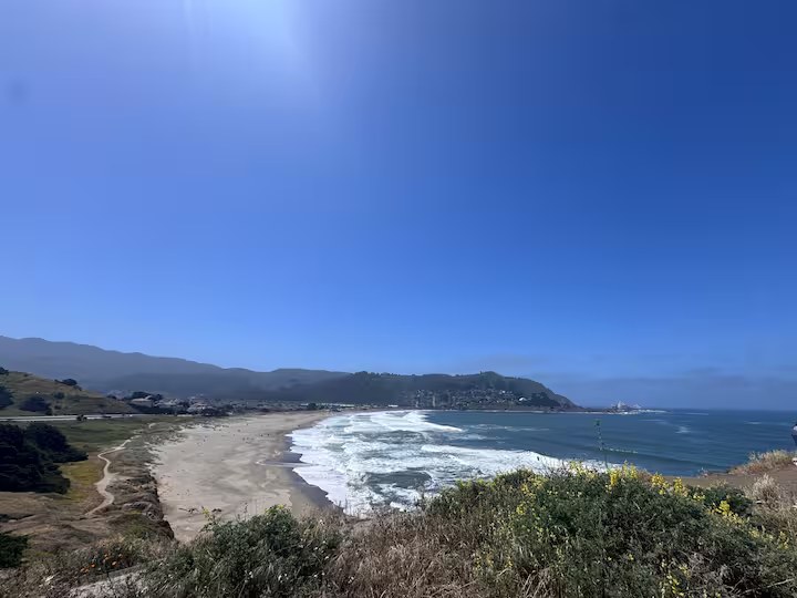
Pacifica is one of California's most accessible surf communities, and our home beach, Linda Mar / Pacifica State Beach, about five minutes away, is the Bay Area's most beginner-friendly break. The water is cold year-round (a 4/3 wetsuit, booties in winter), and mornings are almost always cleanest. Rentals and lessons at Nor-Cal Surf Shop, Sonlight, or Traveler Surf Club. Our home beach is really four breaks strung along one long beach; here is the rundown from south to north.
- South End / Pedro PointAdvanced
A left-hand point break in front of the houses at the south tip. Sharp stone bottom and a crew of veteran locals. Advanced surfers with full board control and good etiquette only.
- "Taco Bell" & the PumphouseAll levels
The mellow middle of the beach, between the (yes, beachfront) Taco Bell and the bathrooms. Beachbreak over shifting sandbars; you will see surfers of every ability here. The friendliest place to learn.
- The North EndIntermediate–advanced
More exposed to swell, so bigger and more powerful, with rip currents and deeper holes. This is the shortboard scene for confident surfers.
- Rockaway BeachInt.–adv. · ~5 min north
A smaller, steeper, punchier beachbreak just north of Linda Mar, with heavier waves and rip tides. Best on a northwest swell at mid tide. The cove setting is beautiful.
- Sharp ParkAdvanced · ~5 min north
An exposed beach-and-pier break near the golf course. Very consistent year-round, best around low tide, but strong rips. A local's wave, so watch for rocks.
If you are visiting specifically to surf, tell me your level and I will point you to the right break for the day's swell, wind, and tide. Respect the rips, and never surf a new break alone.
Hiking: The Pacifica Coastal Bluffs
These are the trails on the ocean side of the highway, where the land falls away in steep bluffs straight to the surf. The most dramatic walks in Pacifica, and the best places for sunset, whale watching, and spring wildflowers. Bring a windbreaker; the coast side is always breezier than town.
Pedro Point Headlands
Moderate · ~2.3 mi loopThe one not to miss: 246 acres of coastal wildlands at the very south end of Pacifica, directly above Shelter Cove. The west side drops 500–600 feet straight to the ocean. The Bluff Trail is the highlight, with views of the headland cliffs, the iconic San Pedro Rock offshore, and (on a clear day) the coast all the way to Mt. Tamalpais and Point Reyes. The loop tops out at Pedro Summit with a 360-degree panorama. Park at the small Devil's Slide north lot off Highway 1, which fills early.
Devil's Slide Trail
Easy · 1.3 mi each wayA paved, mostly level walk along a former cliff-edge segment of Highway 1, high above the Pacific. Edge-of-the-world ocean views, benches along the way, and one of the best whale-watching perches on the coast. Bring binoculars. Shares its north lot with the Pedro Point trailhead, so you can pair the two.
Mori Point
Easy–moderate · ~2.6 mi loopA short, dramatic bluff loop above the ocean. Superb for sunset, whale watching, and wildflowers, with the Golden Gate Bridge visible on a clear day. Start from the flat Old Mori Trail near Sharp Park Beach. One trailhead sits beside the dreamily serene Shelldance Orchid Gardens off Highway 1.
Esplanade Bluffs & the Coastal Trail
Easy / flatThe Coastal Trail runs behind Sharp Park Beach out to the Pacifica Pier, and the bluffs along Esplanade Avenue give big, open Pacific views. These cliffs are actively eroding, so stay back from the edge. Still, the sea air and the sunsets here are wonderful.
Milagra Ridge
Easy · short paved pathsA gentle option just north: a low, scrub-covered ridgeline with easy paved paths, big coastal views, a stone labyrinth, and superb birdwatching. Critical habitat for the endangered Mission Blue Butterfly.
Two cruiser bikes are yours during your stay, and every route here is just as lovely on foot. Flat, paved, beginner-friendly, no hills required. (The signature longer ride down to the Ritz-Carlton lives in Ring 3.)
- Down to Linda Mar Beach: Very easy · a few minutes. Roll or stroll down to Pacifica State Beach for a coffee, a look at the surf, or a barefoot walk on the sand. Lock up by the beach lot and grab something from the cafés across Highway 1.
- The Pacifica Beachfront: Easy · flat & paved. Follow the flat paths and quiet streets along the Pacifica shoreline at your own pace, taking in the ocean air. An ideal sunset spin or evening walk with no destination in mind.
Pacifica has earned a reputation as one of Northern California's premier mountain biking destinations, with honest climbs and ridgelines that open onto the ocean, most starting within minutes of the house. These rides are for your own mountain bike; the cruisers are better on the flat routes above. Gearhead Bicycles in Pacifica handles repairs and trail beta.
~15–20 minutes · Pacifica south to the Ritz-Carlton
Point the car south on Highway 1 and the coast opens up: tide pools at Moss Beach, the legend of Mavericks off Pillar Point, the harbor at Princeton, and the long bluff-top trail that ends with lunch at the Ritz-Carlton.
Princeton Harbor to the Ritz-Carlton
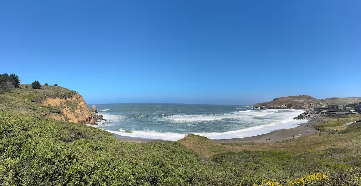
This is the ride worth planning a day around. It is wonderful on a cruiser, and a beautiful walk in sections. Drive south to Pillar Point Harbor in Princeton-by-the-Sea (about 15–20 minutes), then follow the Half Moon Bay Coastside Trail south along the bluffs. It follows the old Ocean Shore Railroad route along open bluffs and ends right at the Ritz-Carlton, pull up, lock the bikes, and have lunch on the bluff with the Pacific in front of you. About 7.5 miles one way, flat and mostly paved.
- Fitzgerald Marine ReserveMoss Beach · ~10 min
At low tide, some of the best tide pools on the coast, with sea stars, anemones, and crabs among the rocky reef. Check a tide table and go on a low, ideally minus, tide. The reserve closes for harbor-seal pupping season, roughly March through June.
- Montara State Beach~12 min
A wide, pleasantly coarse-sand beach usually less crowded than Linda Mar. It is a fine stop for a quieter walk or a picnic just over Devil's Slide.
- Gray Whale Cove TrailEasy · ~2 mi round trip · ~12 min
A gentle, mostly level trail in McNee Ranch State Park that contours the hillside above Highway 1, just south of Devil's Slide, with breathtaking ocean views on a clear day. One of the best places on the Coastside for spring wildflowers, where blue Douglas iris, wild hollyhock, and buttercups carpet the slopes. A steep staircase drops to the cove beach itself if you want to make it a swim or picnic stop. The same trailhead also connects to the North Peak Access Trail for the longer Montara Mountain climb.
- Mavericks Bluffs Trail & PierEasy · ~15 min · spectate the break
Walk out the Pillar Point bluff trail from the harbor to the overlook above Mavericks, off Pillar Point. It is one of the world's most famous big-wave breaks. On a major winter swell, waves reach extraordinary heights and draw elite surfers worldwide. You do not surf this; you witness it from the bluff. The flat trail past the harbor and out toward the radar dome gives the best vantage, with tide pools below at low tide. Bring binoculars and a windbreaker. The point is exposed.
- Princeton Jetty / Half Moon BayBeginner–advanced · ~15–20 min
A friendly, versatile jetty-and-beachbreak inside Half Moon Bay, sheltered from the northwest wind. It is often the only rideable spot on a stormy day. The wedge off the jetty barrels for better surfers; move down the beach and it mellows into easy peaks.
The San Francisco Bay Area has quietly become one of the world's premier destinations for wing foiling, with reliable afternoon wind. The marquee launches are bayside (Crissy Field under the Golden Gate, Coyote Point and 3rd Avenue on the Peninsula, Alameda in the East Bay), a drive from here, so see Ring 4 for the full picture. Closer to home, conditions on the open coast are powerful and shifty; ask before you rig.
This is my favorite easy day on the coast: time it so you reach the Ritz around lunch, take the full route back in the afternoon light, and you have had a near-perfect day without breaking a sweat. If you are bringing wing or kite gear, ask me for a current read before you drive out. Conditions change dramatically within a single afternoon.
~30 minutes to 1.5 hours · a full day out
When you want to make a day of it, the coast rewards a longer drive in every direction: north to the city and the headlands, south into farm country and the redwoods, and down the legendary surf coast toward Santa Cruz.
- Fort Funston: Easy · ~1.5 mi loop · ~20 min. The closest of the city's coast walks, right over the Daly City line on San Francisco's southwest edge. A flat cliff-top loop runs along 200-foot sandy bluffs with spectacular Pacific views, past the hang-glider launch platform, and back through coastal scrub. A steep sand ladder drops to a wild, beautiful beach below. One of the city's great off-leash dog beaches, too.
- Sunset Dunes on the Great Highway: cruiser or walk · ~25–30 min. San Francisco closed the Upper Great Highway to cars and turned two miles of oceanfront into a park, the largest pedestrianization project in California history, opened in 2025. Load the bikes (or bring your shoes) and take the whole flat, car-free stretch with Ocean Beach on one side: murals, a hand-tiled octopus sculpture, a bike pump track, ocean-view lounges.
- Lands End & the Sutro Baths: ~30 min. A cliff-top coastal trail at the city's northwest tip with sweeping Golden Gate views, winding above the ruins of the Sutro Baths, the remains of a grand 1896 oceanfront bathhouse, now dramatic stone pools and tunnels right at the water's edge. Start at the visitor center, explore the ruins, then walk out toward Eagle's Point. Pair it with Golden Gate Park and the Presidio's Tunnel Tops park nearby.
- The Ferry Building & the Mission: A restored 1898 food hall and farmers market on the bay (Hog Island Oyster Co. for lunch), and the city's taqueria heartland in the Mission. Have a burrito in Dolores Park, then pastries at Tartine.
Marin Headlands, Muir Woods & Mt. Tam await. Wind up to Hawk Hill for the postcard bridge view; walk the hushed old-growth redwoods of Muir Woods (reserve parking or the shuttle ahead, it sells out); and drive nearly to the top of Mt. Tamalpais for a 360-degree panorama. Stinson Beach and quiet Bolinas round out the coast.
- San Gregorio & Pescadero: ~35–40 min. San Gregorio State Beach is known for the driftwood "stick houses" along the sand; across the road, the 1889 General Store has an eclectic stock and weekend live music. Two miles on, the farm town of Pescadero is famous for artichoke everything, plus R&R Herbs (pick-your-own berries) and Harley Farms Goat Dairy.
- Pigeon Point & Año Nuevo: ~50 min–1 hr. One of the tallest lighthouses in America, guiding mariners since 1872, on a dramatic bluff. Farther south, Año Nuevo holds the world's largest mainland elephant-seal colony, reserve ahead for the winter walks to see the pups born.
- Waddell, Davenport & Santa Cruz: ~50 min–1.25 hr. The storied surf coast: Waddell Creek at the county line (and a kite/windsurf hot spot), the cliff-backed beaches and Shark Fin Cove at Davenport, and the world-class point break of Steamer Lane in Santa Cruz with the boardwalk and West Cliff Drive.
- Henry Cowell & the Santa Cruz Mountains: ~1.5 hr. The easiest old-growth redwoods to reach: a flat 0.8-mile loop among 1,500-year-old giants off Highway 9, with the Roaring Camp steam train running through the forest. Wind home over Skyline through the redwoods as the light goes gold.
My favorite version of the southern day: coast down through Davenport with a stop for a cookie, an hour by the water in Santa Cruz, then home over the mountains on Highway 9 through the redwoods. Two completely different worlds in one loop.
Food & Drink
Coffee, meals, and a drink at day's end, by the same rings.
In the kitchen & on the deck
There is no restaurant closer than your own kitchen, and on this coast that is a feature, not a fallback.
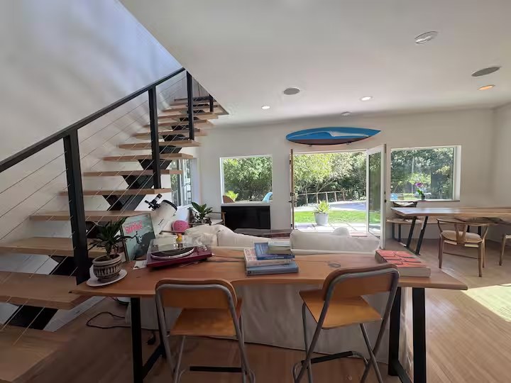
Stock the kitchen with a sourdough loaf from Rosalind Bakery, fresh Dungeness crab off the boats at Pillar Point in season, and produce from the coastside farm stands. Then carry a coffee or a glass of wine up to the rooftop deck at sunset, the view does the rest.
My most-repeated Pacifica ritual is the simplest: fresh-roasted beans brewed on the rooftop deck as the morning fog burns off, or a sunset glass of wine up there after a day in the water. Don't overlook the quietest table in this whole guide, it's the one upstairs.
Seafood & ocean views
Moonraker
Rockaway Beach · $$$Pacifica's special-occasion oceanfront table, fresh seafood, steaks, and big windows over the water. Ask for a window or patio seat at sunset.
Nick's Rockaway
Rockaway Beach · $$A longtime staple right on the water, known for its crab sandwich, a lively bar and lounge, and weekend live music, jazz and cover bands keep the lounge going after dinner.
Puerto 27
Rockaway · $$–$$$Bold Peruvian cooking with a full ceviche bar and pisco cocktails, on a patio overlooking the coast. A standout for groups.
Casual, bakery & nightlife
Gorilla Barbeque & Camelot Fish 'n' Chips
Highway 1 · $–$$Slow-cooked barbecue from a bright orange train car (a Pacifica institution), and the most authentic British fish 'n' chips around in a cozy pub-like room.
Rosalind Bakery
Pacifica · until 7pm dailyA local treasure for sourdough, if any loaves are left when you arrive, grab one. The focaccia-like grandma pizza is a superb backup.
A Grape in the Fog & Winters Tavern
wine bar · live musicPacifica's neighborhood wine bar for flights and charcuterie, and a Sharp Park institution with nightly music, anything from punk to Grateful Dead tribute bands.
~15–20 minutes · Princeton & Half Moon Bay
Fresh Dungeness crab off the boats
Pillar Point · seasonalIn season, buy fresh Dungeness crab straight off the fishing boats at Pillar Point Harbor, the freshest, most local seafood there is. Take it home and cook it yourself for the ultimate Coastside meal.
Sam's Chowder House & Barbara's Fishtrap
Half Moon Bay · $$–$$$An oceanfront seafood house famous for its lobster roll and chowder, with a deck over the water; and a no-frills harborside favorite for fried and grilled seafood right on the water.
Dad's Luncheonette
Half Moon Bay · $$A fine-dining chef cooking out of a red railroad caboose on Highway 1, a tightly focused menu of excellent burgers and comfort food. A only-on-the-coast find.
Jettywave Distillery & HMB Brewing
firepitsCraft spirits and a harborside brewpub, both with outdoor firepits, a relaxed way to end a Coastside afternoon.
The creek corridor and surrounding hills support a surprising amount of life.
Move slowly, look closely, and the place rewards you.
Common sightings
- Black-tailed deer at dawn and dusk
- Black squirrels and ground squirrels
- Red-tailed hawks and turkey vultures on the thermals
- Great blue herons working the creek
- Songbirds, thrushes, chickadees, spring warblers
- Seasonal steelhead in their spawning habitat
On rare occasions, bobcats and mountain lions have been observed in the surrounding open space, a reminder that this is genuinely wild country at the edge of the city.
The creek is seasonal steelhead spawning habitat, a living thread connecting these hills to the open Pacific.
Please enjoy wildlife responsibly and never feed animals. Observing from a distance keeps both you and them safe, and it keeps the corridor the kind of place where wild animals are willing to appear at all.
A working part of this watershed and this community.
Casa Blanca Pacifica is more than a vacation rental. The property actively participates in local environmental stewardship and serves as one of the community monitoring locations used for ongoing creek and water-quality testing within the San Pedro Creek watershed. The data gathered here helps researchers and neighbors understand the health of the creek over time.
The property also supports local nonprofit events, surf contests, and beach-safety programs through volunteer efforts and equipment support.
- Observe the creek and its wildlife from the paths, at a distance
- Keep the corridor clean, pack out everything you bring down
- Use water thoughtfully; it all flows back toward the sea
- Ask about local stewardship events during your visit
When you stay here, you are helping support those efforts, and the creek thanks you.
A few practical notes to make your stay smooth, from someone who knows this coast in every season.
Packing for the coast
Pacifica weather is famously changeable, sunshine and fog can trade places within an hour. Layers are the secret to enjoying the coast in any season.
- Warm layers and a windproof outer layer
- Shoes you can hike or scramble in
- Sunscreen for clear hours; a beanie for foggy ones
- The ocean is cold year-round, wetsuits recommended
Rhythms of the day
- Mornings are often the clearest and calmest, best for surfing, photography, and quiet trails.
- Afternoon wind comes up along the coast and bay, which is exactly what wing foilers want.
- Evenings belong to the rooftop deck.
- Cell service can be spotty out at Devil's Slide and Sweeney Ridge, so plan meet-ups in advance.
Whatever you are hoping to do, just ask. The single most useful thing I can offer is a read on the day's conditions, swell, wind, tide, and fog all shift quickly here, and a little local timing turns a good day into a great one.
With Gratitude
May your stay be filled with adventure, relaxation, and a few unforgettable sunsets.